Hiking In The Sierra Nevada Mountains Part One: Nevada City
Posted by John Anthony Law for Copper River Bag Company on 2nd Oct 2015
Hiking in the Sierra Nevada Mountains is an experience not to be missed. We cannot stress this enough. With endless miles of trails and camping spots – you might not ever want to leave. We've put together a little guide of some of the trails here in the hometown of Copper River Bag Company – Nevada City, California. Keep in mind this is only a tiny spec located in the Sierra Nevada Mountains. The Sierras are so vast and the trails are endless. But we can assure you won't ever feel crowded or rushed. Some of the trail heads might be a little busy at times, but people will quickly fan out to where you'll possibly never see another person along the way, which is important so that you can take in the beauty and feel as though you are the only person in the world. Take along one of our tote bags, like our new Cotton Duck Fabric Tote, to help enjoy the final destination picnic spot.
Independence Trail – (South Yuba River, Highway 49)
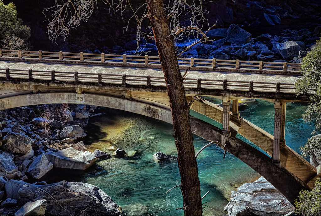
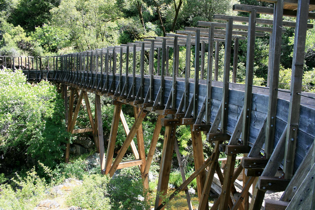
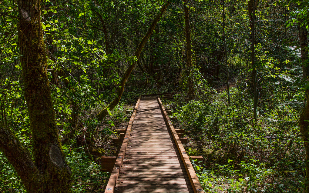
Independence Trail is one of our favorite trails by all of us here at Copper River Bag Co. Every one of us enjoys this trail because of the breathtaking scenery involved. Contouring along wooded hillsides, passing live streams, and crossing deep gorges on restored wooden flumes that once transported water for hydraulic mining, this trail is also wheelchair accessible. About a mile in the trail crosses above a waterfall over Rush Creek which is a highlight of the entire trail. The trail was built around an old gold mining ditch (called Excelsior Ditch) and showcases a great deal of mining history in the area.
A few trail tips provided by the Bear-Yuba Land Trust's website: The most popular section of this trail is the first mile, going out to see the viewpoint (0.4 mile) and the impressive Flume 28 over Rush Creek (1.1 mile) with its waterfall and cascades, especially in wet months. Flume 25 and Flume 26 (at 0.8 and 0.9 mile) are impressive too. There are several benches along the way and a nice picnic table by the closed Diamond Outhouse (0.5 mile).
Directions: Take Highway 49 North from Nevada City for about 4 miles. On the left you will see signs for Independence Trail and parking provided right off the highway.
Hirschman Trail – (Cement Hill Road, Nevada City)
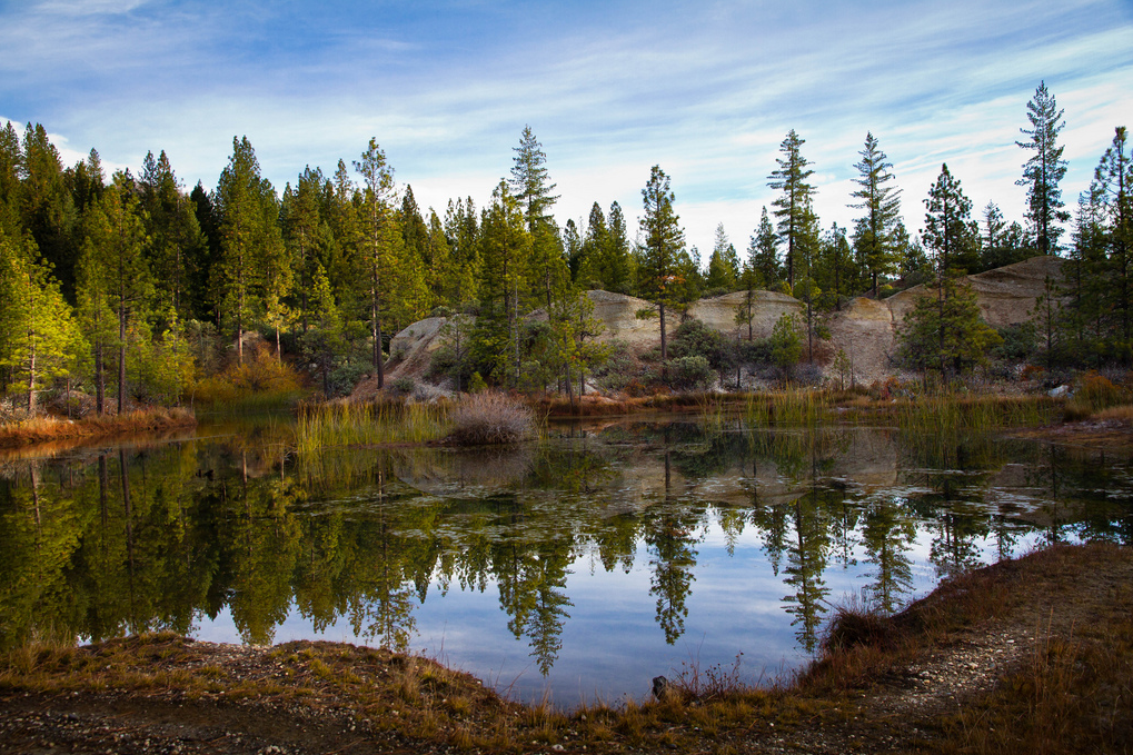
Located at the northern end of Nevada City is Hirschman Trail. At the trail head, right next to the Rood Center is the trail head with parking available. The trail starts out smooth and easy – the best part of it is the first half mile to Hirschman's Pond, which is wheelchair accessible and not to mention family friendly. The trail meanders along some of the most gorgeous scenery - next to wetlands (rare in the Sierras) and huge flat boulders where you can have a seat on the bench and just breathe. As you move along, you will come to Hirschman's pond, which is actually a basin with water left over from hydraulic gold mining done in the 1800s. Nature has persevered and re-created herself, making the once mud pit transformed into a beautiful pond with cliffs and evergreen trees. The trail goes on for about 3 miles, twisting and turning through Oak Woodlands and grasslands. It's a must if you like to jog. Then again, it's a must for a day hike with a picnic at the pond with the family and friends. Our backpacks are perfect to take along with you - and don't be afraid to get them dirty - they'll be just fine.
Directions: Take Highway 49 through Nevada City to Downieville exit. Turn right at Cement Hill Road, trail head is on the left side of the road. Parking available.
Sugar Loaf Mountain – (Coyote Street, Nevada City)
Preserved as “open space” in Nevada City, Sugar Loaf Mountain is a highlight of the area – a landmark rather. When you're in the area, you'll see a flat topped mountain dominating the skyline. This is Sugar Loaf Mountain. The trail is actually an old road that winds up to the top at about 300 feet. “She'll be comin' round the mountain” always plays in my head when taking this trail because it literally spirals up the mountain side. At the top are benches that overlook the entire basin. The view offers some of the best of the Sierra Foothills and the city below. Take a trip at dusk to watch the sunset to the west as well as take in views of nature at its finest – especially in the fall months. Absolutely stunning.
Directions: Take Highway 49 through Nevada City. Turn left at the Downieville exit, right at Coyote Street and climb up to the top. The parking is in a residential area so be respectful of the neighbors, but of course, you already knew that.
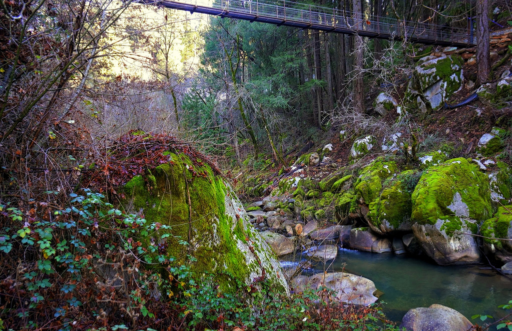
Deer Creek Tribute Trail (Old Downieville Hwy, Nevada City)
This 8.6 mile looped trail is one that cannot be missed. Refinished in 2014, a suspension bridge has been added to this trail which winds along Deer Creek. This is a perfect trail for runners but also for those who want some beautiful surroundings. The trail is long enough to make it the perfect day-hike and because it stays along the creek, it will keep you nice and cool in the summer. The trail head is actually in Nevada City's historic downtown and if you follow the signs – the trail offers a self-guided tour of Downtown Nevada City.
Directions: Take Spring Street in Nevada City to a left at Factory Street. Follow the signs to Old Downieville Highway and park along the road. The trail is heavily marked – so you can't miss it.
There are so many trails throughout the Sierra Nevada Foothills that it's impossible to list them. But we'll be posting more and more detailed trail information to help you plan that perfect day hike, weekend hike, or weeks long hike. It's a perfect getaway and easily accessible so come out and get back to nature. Remember when you're in town to stop by the headquarters of Copper River Bag Company to get a feel of what we're all about. We take pride in where we're from and you'll see how that shows through what we do and hope that enjoy your stay here in our little town.
Here's Some Quick Links to Help You Plan Your Hiking Adventure:
- Bear Yuba Land Trust Website
- Information On Everything Downtown Nevada City
- Trail Map of the Nevada City Area
- Camping and Hiking Gear from REI
- Travel Gear from Copper River Bag Co